top of page

General Aerial Virtual Tour
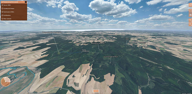
Virtual tour taken at very high altitude locating Haumont-près-Samogneux in relation to the other villages of the Circuit of Destroyed Villages.
Superimposed views show you the relief, the landscape in 1954, the historical and cultural sites in the surrounding area and above all the location of the houses before destruction according to the Napoleonic cadastral plan.
Virtual tour of the tour route
Follow the tour route and discover all the remains of the village.
You can switch to aerial view at any time by looking up at the sky and clicking on the active point.
Virtual tour of the Chapel
This interactive virtual tour takes you inside
of the chapel closed to the public.
Documents and commentaries enrich
the visit.
bottom of page